East Mount Lowther photo
East Mount Lowther
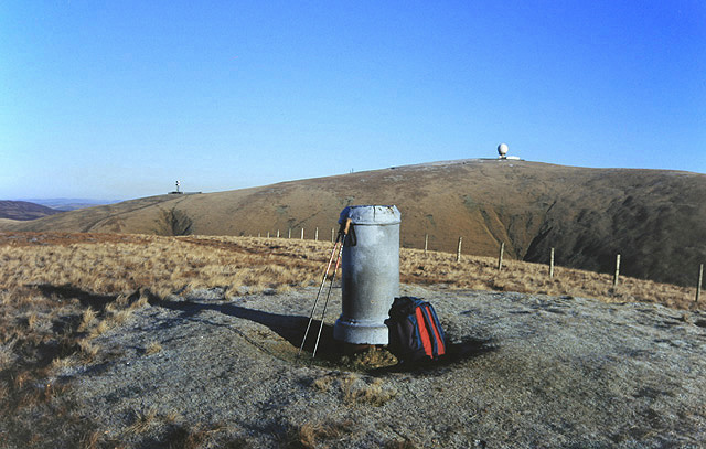
Although this hill is called East Mount Lowther it is actually southwest of Lowther Hill at 631m. The viewpoint indicator was erected by Wanlockhead Youth Club. The golf ball dome of the radar station on Lowther Hill is to the right of the indicator and the radio station on Green Lowther is to the left. From the summit on this clear December day I was able to make out Scafell 67 miles away, Merrick 32 miles away, Goat Fell and the Arran ridges 58 miles away, Ben Lomond 66 miles away, Ben More and Stob Binnein 77 miles away and Ben Cruachan 92 miles away. According to the Explorer map the indicator is just inside the square.
© Walter Baxter and licensed for reuse under this Creative Commons Licence
Taken at: East Mount Lowther, near Sanquhar
Date taken / added: 20th Dec 1998