Hail Storm Hill (boundary) photos
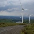
Scout Moor Wind Turbine No 25 goes live
and licensed for reuse under this Creative Commons Licence
Hover over the map markers to see associated photo. Note, some markers show photographer's position whilst others show photo subject location.
['Scout Moor Wind Turbine No 25 goes live',53.6661,-2.23757,'/public/geophotos/754136.jpg'],['Turbine Tower No 25 undergoing final testing',53.6661,-2.23757,'/public/geophotos/754154.jpg'],['Turbine Tower No 25',53.6661,-2.23757,'/public/geophotos/754224.jpg'],['Scout Moor Wind Turbine No 25 goes live',53.6661,-2.23757,'/public/geophotos/1049950.jpg'],['Wind farm track on Hail Storm Hill',53.666,-2.23591,'/public/geophotos/2987279.jpg']


